 What
What

Build redundancy into your navigation capabilities and execution.
Why
As to the “why”, well, getting lost is no fun and could be deadly. Our phones are super capable, and with GPS navigation, it takes the work out of figuring out where you are and how to get somewhere. It also makes us a little too dependent on our phones. Breaking your phone, or running out of power can put you in danger if you don’t have a backup plan.
If your hike is on a well established trail, like the PCT, you may feel like your navigation risk is low but if a fire sparks up, or a flash flood closes off your return route, that won’t be the case.
Hikes that seem simple can look completely different on the way back under different lighting or become a real adventure if you are forced to take a different path.
What I And Others Do
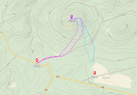
Research & study the area of operation. Become familiar with the area, the planned route, and key landmarks during your research prior to your expedition. This improves your confidence and reduces the chance of getting lost. I put this at the top of the list because it supports everything below.
Don’t forget to download off-line maps. As mentioned in an earlier tip, cell service in the backcountry can be unreliable or non-existent. Arriving at your launch point or deep into your hike with no map available can be a real problem. Most navigation apps like GaiaGPS, CalTopo, Alltrails and others allow you to download maps to your phone for when you don’t have cell service. I’ve forgotten to do this and it almost ended the start of my hike into a new area, except I had studied the area extensively before I left and knew I could get cell coverage not too far from the car and I could bail at that point if it didn’t work out.

Carry a compass! During a hike, I stop at places that I know I can get to and take a bearing to my car or other known location. It’s not a bullet proof solution, but it reduces the risk of wondering around if your phone dies. Also, pay attention to the terrain and key landmarks as you hike to the summit.
Use a backup gps device. Some of our radios have a rudimentary navigation system system built-in, like the Yaesu FT products that allow you to mark where you parked and then navigate back. Many of us have a smart watch that does the same thing. There are other solutions available if you are willing to carry them. But, rather than carry extra stuff, bring a friend with the backup solution.
Carry some paper charts of the area with your compass. I’ve done this when going into an area with no trail if it looked like I’d be venturing into complex terrain navigating to the summit. Paper charts don’t need batteries (they can become wet and disintegrate however). If you don’t feel comfortable using a map and compass, take an orienteering class and go out and practice. We all start from zero and taking the class with a friend can be a lot of fun.
If you become lost, stay where you are, take a break, and evaluate your options while you await search and rescue. Given where I live and hike, I would never recommend you start a signal fire unless your life depends on it. More on that in a later tip. Tip: Don’t start a fire.
Visit HamNinja.com/safetytips to see all the tips as they are published. More safety tips to come.
The Ham Ninja’s SOTA Safety Tips
SOTA Safety Tips is a weekly series of quick tips to remember to improve safety of the hobby. This was inspired by the SoCal SOTA group’s meetings on this topic and will be sourced from my own and others' experience. Don’t forget, you also need to support your group and others with this knowledge. I’ll keep these as short as possible. Send feedback to safetytips@HamNinja.com.
My Experience
I am not a safety or health professional, doctor, or other expert, just an amateur. Be careful out there and do your research. I’ve activated 817+ summits since Oct of 2017 in Southern California, Arizona, New Mexico, and several other states. Over that time I’ve hiked 2,540+ miles and climbed 626,000+ feet. I don’t have skills beyond class 3 hiking and really, “scrambouldering” and light snow pack are my upper skill limits and my hikes are normally 2 miles, NTE 18 miles. I was an Army medic and was a certified EMT. I have received training on desert survival, and recurrent first Aid training in other roles. First Aid is a perishable skill, get training.. You probably also noticed I’m a pilot, steeped in the culture of safety, AKA try not to kill yourself.
You can contact me at safetytips@HamNinja.com.
No comments:
Post a Comment